Business Details
Expert Drone Services for Construction, Agriculture & Real Estate
Highres Drone Services Drone Services is a professional drone photography and videography company dedicated to providing high-quality aerial and ground data solutions. With expertise in construction progress monitoring, precision agriculture, real estate documentation, and infrastructure inspection, we deliver actionable insights through digital twins, orthomosaic maps, and 3D models. Our commitment to clear communication ensures clients' visions are realized, while our flexible scheduling and rapid turnaround cater to time-sensitive projects.Operating across Washington, Oregon, Idaho, and Brazil, we combine cutting-edge drone technology with decades of field experience to support industries ranging from agriculture to energy infrastructure. Our services reduce costs, improve safety, and enhance project efficiency through accurate volumetric analysis, crop health monitoring, and precision spraying solutions tailored to client needs.
Services
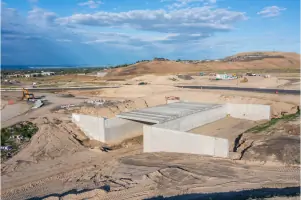
Construction Monitoring
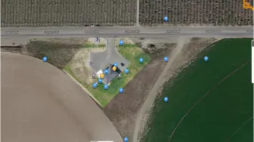
Crop Health Analysis
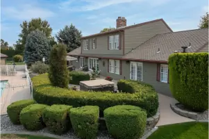
Real Estate Photography
Infrastructure Inspection
3D Modeling
Precision Spraying
Stockpile Analysis
Orthomosaic Mapping
Highlights and features
- We provide 7-day scheduling flexibility for time-sensitive projects
- Our digital twin technology enables real-time construction progress tracking
- Specialized crop health monitoring with NDVI imagery analytics
- We offer multi-state coverage across the Pacific Northwest and Brazil
- Our earthworks analysis delivers accurate volume measurements within hours
Services
Construction Monitoring
Our drone-based construction monitoring captures progress from groundbreaking to completion. Digital twins and orthomosaic maps help track timelines, manage resources, and share updates globally. Ideal for investors and project managers needing accurate documentation.
Crop Health Analysis
NDVI imaging and multispectral analysis identify crop stress areas. We detect pests, disease, and irrigation issues while providing stand counts and canopy coverage metrics. Compatible with precision spraying systems for targeted treatment applications.
Infrastructure Inspection
Routine maintenance checks use aerial photogrammetry to assess critical infrastructure. Our 3D models document wind turbines, power lines, and industrial sites without risking crew safety. Enables proactive maintenance planning through detailed visual analysis.
Real Estate Photography
Professional aerial and ground photography packages showcase commercial/residential properties. Includes virtual tours, edited videos with licensed music, and 360-degree panoramas. Delivered within 1-2 days with flexible scheduling options.
Earthworks Analysis
Drone-collected elevation data enables rapid earthwork measurements. Tracks stockpile volumes and construction material inventories. Helps bidding accuracy and project scheduling through precise quantification of site grading requirements.
People
Eric Nicolaysen
Owner/Operator
Eric Nicolaysen brings extensive UAV expertise to Highres Drone Services Drone Services, specializing in construction monitoring and agricultural analytics. Certified under FAA Part 107, he provides Agroscout software support and field-proven drone solutions for diverse industries.
Questions
What areas do you serve?
We cover Washington, Oregon, Idaho, and select locations in Brazil. Custom service areas available for large-scale projects requiring specialized drone operations.
Do you offer construction project monitoring?
Yes, we provide comprehensive construction progress tracking using digital twins and orthomosaic mapping. Services include pre-bid inspections to grand opening documentation across multiple project phases.
Can you help with agricultural pest detection?
Our NDVI imaging identifies crop stress areas while integration with Agroscout software detects specific threats like PVY in potatoes using specialized AI algorithms.
What real estate services do you offer?
We provide aerial and ground photography, 3D virtual tours, and edited marketing videos for property listings. Standard turnaround time ranges from 1-2 days with flexible scheduling options.
Do you support precision spraying operations?
Yes, we generate prescription maps for DJI Agras spraying drones using multispectral data analysis. This enables targeted chemical application that reduces costs and environmental impact.
Reviews (5)
Troy Waterman
Oct 29, 2021
Report
Positive:Professionalism,Quality,Responsiveness,Value
I had the pleasure of working with Eric on an aerial project in Central Washington. He was great to work with on location, responsive before/after the shoot and the footage looked great too! Would definitely recommend!!
I had the pleasure of working with Eric on an aerial project in Central Washington. He was great to work with on location, responsive before/after the shoot and the footage looked great too! Would definitely recommend!!
JanaLove
Jan 18, 2021
Report
Positive:Professionalism,Quality,Responsiveness,Value
I found Eric extremely easy n professional to work with. Top quality. Great w communication.
I found Eric extremely easy n professional to work with. Top quality. Great w communication.
AquaDamInc
Sep 01, 2020
Report
Hired HighRes to document job site progression. Eric was extremely responsive, and took beautiful imagery that was worth every penny. He has a good eye, and knows how to fly nice and slow. He was on site every time he was scheduled, except for bad weather. Very happy with his service, and will be following up in case of future jobs in the area.
Terra Dye
Jul 21, 2020
Report
Our office has used Eric for the past year to capture our real estate aerial shots/video. Eric provides high quality footage in a timely manner and is very flexible with scheduling. Highly recommended!
Tais Nicolaysen
Oct 12, 2019
Report
This is a great aerial photograph, he made some videos for my channel on YouTube, and it was amazing.