Business Details
Emergency
services
Professional Aerial Photography & 3D Virtual Tours in Dallas, TX
North Texas Skyworks is a fully licensed and insured photography and videography company serving residential and commercial clients across the Dallas-Fort Worth area. Our team of FAA Part 107 licensed remote pilots combines cutting-edge technology with a passion for capturing precise, high-quality aerial and ground-level imagery. We specialize in 3D virtual tours, Matterport scans, and Google Maps integration, enabling clients to showcase properties and businesses with unparalleled accuracy. Our services extend to renovation space measurements, insurance assessments, land mapping, and event coverage, all delivered with a commitment to treating clients like family.With state-of-the-art equipment including DJI drones and Matterport Pro 2 scanners, we ensure every project exceeds expectations. Our expertise in photogrammetry and 400-foot aerial capabilities allows us to provide data-driven solutions for construction progress tracking, livestock recovery, and fence surveys. As an approved Google Photographer, we help businesses enhance their online presence through immersive virtual experiences. Our dedication to innovation, precision, and customer satisfaction has positioned us as a trusted partner for clients seeking comprehensive visual documentation solutions.
Services
Aerial Photography
3D Virtual Tours
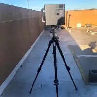
Matterport Scans
Google Maps Integration
Insurance Assessments
Land Mapping
Job Site Progress
Event Videography
Livestock Recovery
Fence Surveys
Highlights and features
- We are FAA Part 107 licensed remote pilots with UAV/sUAS rating.
- We utilize top-of-the-line technology including DJI drones and Matterport Pro 2 scanners.
- Our Matterport scans provide measurements within 1% of ground truth accuracy.
- We are an approved Google Photographer enhancing business visibility on Google Maps.
- We offer comprehensive services from aerial photography to 3D virtual tours and land mapping.
Associations and certifications
Services
Aerial Photography
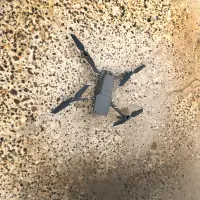
Our FAA-certified pilots capture high-resolution aerial imagery using DJI drones capable of flying up to 400 feet. This service provides marketing materials, property overviews, and construction documentation with precise angles and coverage. Clients receive ultra HD 4K video and stills that showcase properties or events from unique perspectives.
3D Virtual Tours
We create immersive 3D walkthroughs using Matterport Pro 2 technology that allows clients to explore spaces remotely. These tours include accurate measurements within 1% tolerance and generate floor plans, point clouds, and CAD-compatible files. Ideal for real estate, commercial properties, and model homes needing digital representation.
Land Mapping
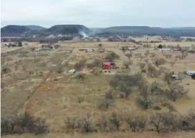
Our drones capture photogrammetric data for land mapping and boundary documentation. This service supports agricultural planning, construction projects, and property assessments with detailed elevation models and vegetation analysis. Deliverables include 3D maps and progress comparisons for ongoing developments.
Insurance Assessments
We provide aerial documentation for insurance claims including roof condition analysis and property damage assessments. Drones capture high-resolution images of hard-to-reach areas, creating comprehensive reports that streamline claims processing while minimizing physical risk to inspectors.
Event Videography
Our team captures dynamic aerial footage of sporting events, festivals, and large gatherings using high-speed DJI drones. This service preserves memories with cinematic shots and provides organizers with promotional content that highlights event scale and atmosphere.
Questions
What types of services do you offer?
We provide aerial photography, 3D virtual tours, land mapping, insurance assessments, event videography, livestock recovery, and fence surveys using drone technology and Matterport scanning.
Are your operators FAA certified for drone operations?
Yes, all our pilots hold FAA Part 107 licenses with UAV/sUAS ratings for legal commercial drone operations.
How accurate are your Matterport 3D scans?
Our Matterport scans achieve measurement accuracy within 1% of ground truth, providing reliable data for renovations, real estate listings, and construction documentation.
Can you help improve our business visibility on Google Maps?
As an approved Google Photographer, we create 360° virtual tours that integrate directly with Google Business listings to enhance customer engagement.
How do we schedule a service appointment?
Contact us via phone at 469.471.1072 or through our website contact form to discuss availability and specific requirements for your project.
Videos
Reviews (1)
Irene Kneeland
Jul 14, 2018
Report
I recently had the pleasure of dealing with both Ryan and Michael. I rented a Leica blk 360 scanner from North Texas Skyworks as a first time user, and their help and support made this a very successful first shoot for my company. They really know their stuff, and have a lot of experience working with large spaces, so when a daunting project came up for me, they shipped out the camera just as they said, gave me pointers before, during and after that made the process seamless and successful. I really appreciate all they did for me and my client (my sister). Now I have the confidence to rent again