Business Details
23 Years
experience
Emergency
services
Trusted Enterprise Software for Utilities & Local Governments
Novotx is a dedicated software development company specializing in enterprise solutions for utilities and local governments. With over two decades of experience, we create intuitive, GIS-centric platforms that streamline asset management, permitting, citizen engagement, and field operations. Our team prioritizes simplicity and functionality, ensuring public sector teams can focus on building safer, stronger communities without technological complexity.We emphasize real-time data integration, seamless ArcGIS compatibility, and customizable workflows to meet unique organizational needs. Our support team guarantees rapid response times and prioritizes customer satisfaction, while our development process incorporates direct user feedback to shape future platform enhancements.
Services
Asset Management
Citizen Requests
Permits & Licensing
GIS Integration
Mobile Applications
Details
- Year established: 2003
Highlights and features
- We offer 20+ years of public sector software expertise
- Our platforms integrate directly with ArcGIS for real-time mapping
- We provide unlimited custom fields and automations
- Our support team guarantees 1-hour critical response times
- We combine asset management with citizen engagement tools
What people say
Fantastic deployment
Expert knowledge
Seamless integration
Real-time visibility
Responsive support
Services
Asset Management
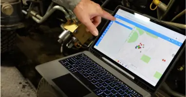
Our GIS-driven platform centralizes infrastructure management for roads, water systems, and public facilities. Real-time asset scoring enables proactive maintenance planning while integrated work order systems track maintenance history and costs. Spatial analytics combined with risk assessment tools help agencies prioritize capital improvement projects based on asset condition and criticality.
Citizen Requests
The Connect portal allows residents to report issues via map-based interfaces with photo attachments. Automated workflows route service requests to appropriate departments while status tracking keeps citizens informed through resolution. Integration with GIS systems ensures accurate location data for all reported incidents.
Permits & Licensing
Our platform streamlines permit processing from application to approval with customizable forms and payment integration. GIS-based validation checks ensure compliance with zoning regulations while automated inspection scheduling reduces administrative overhead. Digital records maintain complete audit trails for regulatory compliance.
GIS Integration
Direct integration with Esri's ArcGIS provides real-time spatial data visualization and analysis. Map-based asset management enables simultaneous editing of multiple features while location-based analytics support data-driven decision making across departments without data synchronization requirements.
Mobile Applications
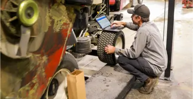
Native mobile apps support offline field work with synchronized data updates. Features include work order completion, asset inspections, and inventory management accessible on iOS and Android devices. GPS tracking ensures accurate location data collection even in remote areas without connectivity.
People
Mary-Clare Jared
Implementation Specialist
With 15+ years in public sector software deployment, she specializes in GIS integration and workflow optimization. Her expertise ensures smooth transitions to digital systems while maintaining operational continuity during implementation phases.
Alan Clinton
Administrative Planning Officer
As Kauai County's implementation leader, he directed digital workflow transformation through Elements XS integration. His institutional knowledge bridges technical capabilities with regulatory requirements for land management applications.
Questions
What platforms does Novotx integrate with?
Our software natively integrates with Esri's ArcGIS, payment processors, utility billing systems, and 811 locate services.
Can the platform handle custom workflows?
Yes, we offer unlimited custom fields, forms, and automations without requiring coding expertise.
Is mobile access available?
Our mobile apps support offline operations for iOS and Android devices with sync capabilities.
How does support work?
We use a four-tier system with guaranteed response times from 1 hour (critical) to 1 business day.
What asset types can be managed?
Our system handles water, wastewater, stormwater, streets, parks, fleets, and utility infrastructure assets.