Business Details
Advanced Geoscience Software Solutions
Founded in Denver, Colorado, GVERSE GeoGraphix has pioneered geoscience software innovation since its inception. As a market leader in G&G software, we deliver advanced geological and geophysical interpretation tools designed for exceptional performance and affordability. Our platform integrates mapping, structural modeling, well planning, and 3D visualization with a focus on optimizing workflows for both conventional and unconventional energy projects. With scalable solutions tailored for consultants and multinational corporations alike, we emphasize user-centric design, flexible licensing models, and interoperability with industry-standard software ecosystems. Our commitment to technological advancement is reflected in continuous enhancements to geophysical interpretation capabilities, subsurface modeling speed, and core geoscientist workflows.Backed by a common data architecture and low IT infrastructure requirements, our solutions reduce operational complexity while maintaining 30% lower costs compared to competitive offerings. Through strategic investments in cloud integration, big data analytics, and deep learning technologies, we empower geoscientists to achieve greater productivity in diverse geological projects. Our customer-centric approach combines powerful software tools with responsive support services, ensuring rapid resolution of technical challenges and seamless implementation across organizations of all sizes.
Services
Geological Interpretation
Geophysical Analysis
Data Management
Field Development
Value Added Services
Highlights and features
- We offer 30% lower costs than comparable geoscience software platforms
- Our solutions feature seamless integration with major industry software ecosystems
- Flexible licensing models allow payment for only required functionalities
- Scalable tools support both small consulting firms and multinational corporations
- Low IT infrastructure requirements reduce implementation complexity
What people say
Very helpful
Knowledgeable
Efficient
Powerful software
Rapid resolution
Services
Geological Interpretation
Advanced tools for structural and stratigraphic analysis enable precise subsurface mapping and geosteering. Our platform combines 3D visualization with workflow optimization for conventional and unconventional reservoir characterization. Geoscientists benefit from integrated data management and real-time collaboration features that enhance interpretation accuracy.
Geophysical Analysis
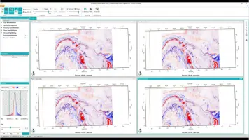
Powerful 2D/3D seismic interpretation systems accelerate prospect generation through automated pattern recognition and multi-attribute analysis. The platform supports rapid velocity modeling and time-depth conversion while maintaining compatibility with industry-standard data formats for seamless workflow integration.
Data Management
Centralized data management solutions streamline well information organization, query execution, and cross-team collaboration. Our system provides secure data sharing capabilities with version control and audit trails to maintain data integrity across enterprise operations.
Field Development
Integrated subsurface-to-surface planning tools optimize field development through accurate well trajectory design and production forecasting. The platform bridges geological insights with engineering execution for improved reservoir management and operational efficiency.
Value Added Services
Comprehensive services include data migration, system upgrades, and performance optimization. Our experts provide project recovery solutions and customized implementation support to maximize software ROI while minimizing technical disruptions.
Questions
What geoscience disciplines does GVERSE GeoGraphix support?
Our platform supports geological interpretation, geophysical analysis, petrophysical evaluation, structural modeling, and field development workflows.
How does the software handle large-scale projects?
The platform offers scalable solutions with optimized performance for both small-scale consulting projects and multinational energy company requirements.
What integration capabilities exist with other software?
Our tools feature interoperability with major geoscience software suites, enabling collaborative workflows and data exchange across platforms.
What support options are available?
We provide remote support, case management, knowledge center resources, and real-time technical assistance for implementation and troubleshooting.
How is licensing structured?
Flexible licensing models allow organizations to pay only for required functionalities with options for user-based pricing and license transfers.
Videos