SkyIMD designs and develops complete aerial imaging solutions for light planes and helicopters. Our systems have been deployed for use in the US, Honduras, Australia, South Africa, Brazil, France and Canada to assist with a multitude of imaging needs. Our aerial imaging platforms, cameras and turn-key solutions are approved for over 30 different aircraft and in over 55 different countries.
We continually test new cameras, sensors and technologies to integrate into our solutions. We work with large corporations and individuals to create specific and multi-purpose solutions for their or their clients' needs. SkyIMD began developing solutions for Unmanned Aerial Vehicles (UAV) under a NASA grant in 2006.
We continually test new cameras, sensors and technologies to integrate into our solutions. We work with large corporations and individuals to create specific and multi-purpose solutions for their or their clients' needs. SkyIMD began developing solutions for Unmanned Aerial Vehicles (UAV) under a NASA grant in 2006.
Services
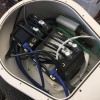
Aerial Camera Platform
Report
Aerial mapping of the Northern California, Napa Valley, Fires using a Phase One 100 megapixel aerial camera. Mount St. Helena in the background. Orange color on the mountain is fire retardant. We design and develop complete FAA/EASA/ANAC STC (supplemental type certificate) aerial imaging solutions for manned planes and helicopters.
Aerial Mapping Configurations – DSLR, Mirrorless, Medium Format...
Report
Capture Awesome and Professional Quality Geo-coded Aerial Images with a DSLR, Mirrorless or Medium Format Digital Camera. Taking photos from a plane usually means dealing with a lot of inconvenience and getting blurry or obstructed shots. SkyDSLR eliminates these hassles and lets you take stunning vertical and oblique photos and video using your DSLR camera, in a fast, safe and cost effective manner.
Aerial Imaging Services
Report
We have Parts Manufacturing Approval - FAA PMA - almost any sensor or camera configuration that fits can fly!. Since 2008, SkyIMD has developed and configured aerial camera and sensor configurations for almost every manned aerial imaging and data acquisition market segment. Oroville Dam in California - orthomosaic - showing the damage after recent overflow from numerous rain storms.
Tools
Report
Aerial photogrammetrists, imaging, mapping and surveyors. Use our online flight planner to plan the flight paths and determine ground spatial distance (GSD) and camera trigger intervals (time and distance). Upload a. KML parcel boundary and see the flight paths calculated over the parcel. All settings are "live" - after entering or changing a setting you will see the results displayed on the map dynamically.
Swath & Pixel Density Calculator
Report
Enter the values for your aerial imaging project, then press the Calculate button to obtain values that will inform your flight plans. Or refer to your camera's technical specifications to find the sensor resolution (pixels) and dimension (mm). Know your maximum ground speed so that you do not reduce the overlap percentage by flying too fast.
Reviews

Be the first to review SkyIMD.
Write a Review