
Business Details
25 Years
experience
Trusted Real Estate Parcel Data & GIS Tools for Florida Professionals
MapWise has been a trusted provider of real estate data and mapping solutions for Florida professionals since 2001. Our platform delivers comprehensive parcel data, tax roll information, and geospatial analytics through intuitive web applications. With decades of industry experience, we specialize in integrating high-resolution aerial imagery, flood zone assessments, and zoning details to support precise land evaluations. Our team of GIS experts and software developers maintains direct partnerships with all 67 Florida county Property Appraisers to ensure data accuracy.Our services streamline due diligence processes for brokers, developers, appraisers, and environmental consultants while maintaining strict compliance with data privacy standards. Client feedback drives continuous improvements to our mobile-friendly interface and data export capabilities. Our commitment to innovation is demonstrated through our recent launch of the MapWise Explorer platform. We maintain a robust API integration system for automated data retrieval while preserving our reputation as cost-effective solution providers in the real estate technology sector.
Services
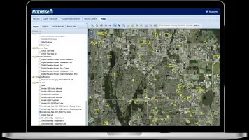
Real Estate GIS Mapping
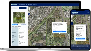
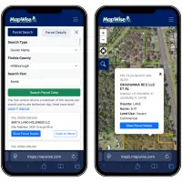
Parcel Data Search
Tax Roll Data Access
Aerial Imagery
Flood Zone Analysis
Zoning Verification
Environmental Assessment
Property History Reports
Data Export Services
API Integration
Details
- Year established: 2001
Highlights and features
- 20+ years of specialized real estate GIS expertise in Florida
- Interactive maps with 70+ data layers for comprehensive analysis
- Direct data partnerships with all 67 Florida county appraisers
- Mobile-optimized platform for on-site property evaluations
- Proprietary API for seamless integration with professional workflows
What people say
Incredibly useful tool
Best value around
Time-saving capabilities
Indispensable tool
Smartest software investments
Services
Real Estate GIS Mapping
Our GIS mapping system provides location-based property insights through layered data visualization. Users can analyze parcel boundaries, zoning classifications, and environmental factors in a single interface. The platform supports spatial queries and custom map creation for professional presentations.
Parcel Data Search
Access statewide parcel information with advanced search capabilities across 30+ parameters. Our system aggregates data from all Florida county property appraisers, including ownership history, legal descriptions, and tax assessments.
Aerial Imagery
High-resolution aerial photography updated to current standards allows detailed property analysis. Users can compare historical imagery layers and overlay features like elevation contours and floodplain boundaries for comprehensive land assessments.
Flood Zone Analysis
Integrate FEMA flood zone data with property-specific elevation measurements to determine risk exposure. The system automatically calculates floodplain percentages and displays regulatory zone classifications for compliance verification.
API Integration
Our RESTful API enables automated data retrieval and system integration with existing business workflows. Developers can access parcel records, sales history, and geospatial metadata through authenticated endpoints with rate-limited access controls.
Questions
Does MapWise offer a free trial?
Yes, we provide a 7-day free trial with unlimited searches, reports, and maps. No credit card is required to start the trial.
What type of real estate analysis can I perform?
Our platform supports parcel boundary verification, zoning analysis, flood zone determination, environmental constraint identification, and market value comparisons.
Is there API access to MapWise data?
Yes, we offer API access with authentication for developers to integrate parcel data into their applications.
Can I use MapWise on mobile devices?
Our MapWise Explorer tool is optimized for mobile use with touch-friendly interface elements and responsive design.
Where does MapWise get its data?
We source data directly from all 67 Florida county Property Appraisers, FEMA flood maps, and USGS elevation models.
How do I start using MapWise?
You can begin with our free trial or contact us for subscription options and customized pricing plans.
Videos